
North Texas braces for severe weather
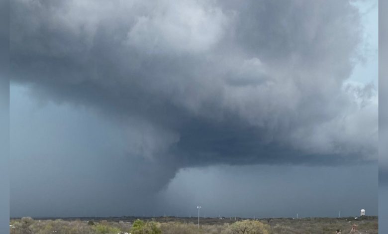
North Texas is bracing itself for severe weather as the Storm Prediction Center sounds the alarm for an Enhanced Risk (Level 3) of storms in most of the region, including the Metroplex.
With all modes of severe weather on the table, the CBS News Texas First Alert Weather Team is advising caution and urging residents to remain vigilant of rapidly changing weather patterns.
A cocktail of atmospheric factors, including a warm front from the south and a dryline from the west, are coalescing to create the volatile weather system. Scattered rainfall and thunderstorms are expected to begin as early as 2 PM and persist throughout the night, carrying with them the potential for localized flooding. To stay ahead of the storm, residents are encouraged to have a contingency plan in case of emergency.
Although the worst of the weather is expected to dissipate by late evening, the threat of severe weather is still very much present. Overnight temperatures will drop to the low 60s, with Monday predicted to bring high temperatures in the low 90s with a slight chance of a shower or storm.
Regrettably, this brief respite will be short-lived, as Tuesday’s weather alert is already in effect. Strong to severe storms are forecast for parts of North Texas, especially east and northeast of I-35 and I-36E, with Marginal, Slight, and Enhanced Risks (Levels 1, 2, and 3) identified by the Storm Prediction Center. CBS News Texas is advising all residents to remain vigilant and stay abreast of the situation as it unfolds.
Wednesday currently appears to be the calm before the storm, but more turbulent weather is on the horizon. The Easter holiday weekend is also predicted to bring unsettled weather. The CBS News Texas First Alert Weather Team is working tirelessly to provide updates and ensure that residents remain informed and prepared.